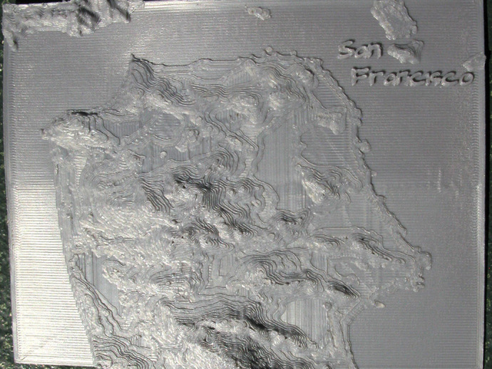
San Francisco Relief Map
thingiverse
NOAA has combined offshore bathymetry with land topography to create coastal relief models of the United States at 3 arc second intervals. A portion of interest can be downloaded using an online program. http://www.ngdc.noaa.gov/mgg/coastal/crm.html A small section of the central California coast was downloaded and used to create a relief map of San Francisco. Source code is provided. Although the data file can be obtained from the NOAA web site a zipped version is included for convenience. Instructions The stl file can be printed directly on the build platform. The print is 9.25 arc minutes in latitude by 12 arc minutes in longitude. The approximate position of the lower left corner is N latitude 37.583333 longitude -122.533333. Mount Davidson, the highest point in San Francisco, is 282 meters, 925 feet, above sea level.
With this file you will be able to print San Francisco Relief Map with your 3D printer. Click on the button and save the file on your computer to work, edit or customize your design. You can also find more 3D designs for printers on San Francisco Relief Map.