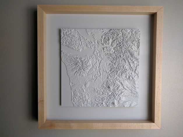
Seattle / Western Washington Topography
thingiverse
Semi-abstracted topographic map of the Seattle / Western Washington Area. GIS data was used merely for an hightfield map, which was imported into Rhino. After creating a mesh from the imported image, it was then extruded and split in Meshmixer. 10" x 10" square; split into four 5" squares. Update 12/7/17: Added 10" x 10" combined version by request. Post-Printing Prints were glued together, primed, sanded, and painted with automotive lacquer.
Download Model from thingiverse
With this file you will be able to print Seattle / Western Washington Topography with your 3D printer. Click on the button and save the file on your computer to work, edit or customize your design. You can also find more 3D designs for printers on Seattle / Western Washington Topography.