Shagawa Lake Depth Map
thingiverse
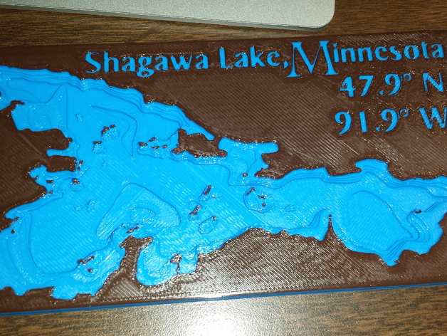
Scaled depth map of Shagawa Lake in Minnesota obtained from the MN DNR website. Printed measurements range approximately 140 mm across and slightly over 1 cm high. Settings were kept default on a Makerbot Rep2 when creating this scale model. A miniature version, entirely blue, was produced at roughly half these dimensions, displaying excellent resolution but requiring minor adjustments to ensure accurate text representation.
Download Model from thingiverse
With this file you will be able to print Shagawa Lake Depth Map with your 3D printer. Click on the button and save the file on your computer to work, edit or customize your design. You can also find more 3D designs for printers on Shagawa Lake Depth Map.