Stonehenge LiDAR Archaeology Landscape
sketchfab
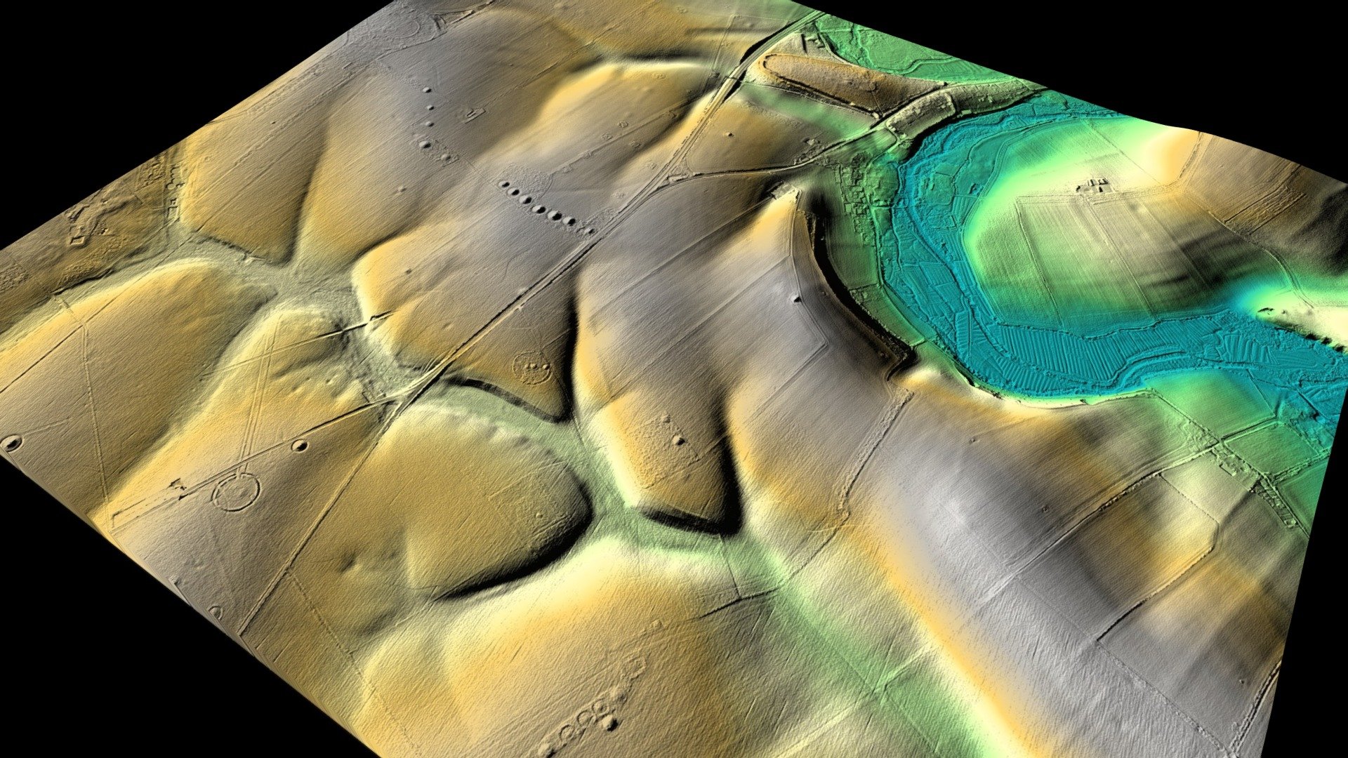
A LiDAR landscape of the key archaeological features around Stonehenge including Stonehenge itself, The Avenue, the Cursus and numerous barrow burial mounds. The 1 metre LiDAR is only partial at Stonehenge with many of the sites to the west not included in the current opendata coverage. This is a digital terrain model version which represents the bare ground surface only so prominent buildings, trees and even the stones of the Stonehenge circles are stripped off in this case. Created using 1 metre DTM LiDAR opendata provided by the Environment Agency. Built in QGIS using the QGIS2threeJS plugin. Thanks to Mike Gill of the Avon Valley Archaeological Society for the python code which converts QGIS models into a format compatible with Sketchfab. Best viewed full screen and in HD (see options at bottom of model view). Feel free to share on various media, download, or embed on your website using the embed code.
With this file you will be able to print Stonehenge LiDAR Archaeology Landscape with your 3D printer. Click on the button and save the file on your computer to work, edit or customize your design. You can also find more 3D designs for printers on Stonehenge LiDAR Archaeology Landscape.