Switzerland and Denmark Relief Maps
thingiverse
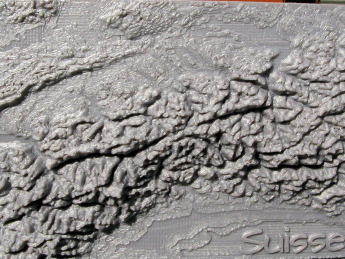
Here are relief maps for Switzerland and Denmark. They are low resolution maps that cover large areas. The maps are: Switzerland.stl 120 x 200 points at 90 arc second intervals Denmark.stl 240 x 180 points at 60 arc second intervals The upper left corner of Switzerland.stl is at approximately 48 degrees north latitude and 6 degrees east longitude and the upper left corner of Denmark.stl is at 58 degrees north latitude and 8 degrees east longitude. Data for the maps came from the Global Mapping project. http://www.iscgm.org/cgi-bin/fswiki/wiki.cgi Data from Global Mapping is designed to be easily visualized. One way to do so is to use the many KML files available at the site. KML files open in Google Earth. Instructions The maps are best printed directly on the build platform. Elevation data obtained from Global Mapping comes as unformatted signed 16 bit bigendian integers. The fortran program used to create the openSCAD code that produced the map of Switzerland is included.
With this file you will be able to print Switzerland and Denmark Relief Maps with your 3D printer. Click on the button and save the file on your computer to work, edit or customize your design. You can also find more 3D designs for printers on Switzerland and Denmark Relief Maps.