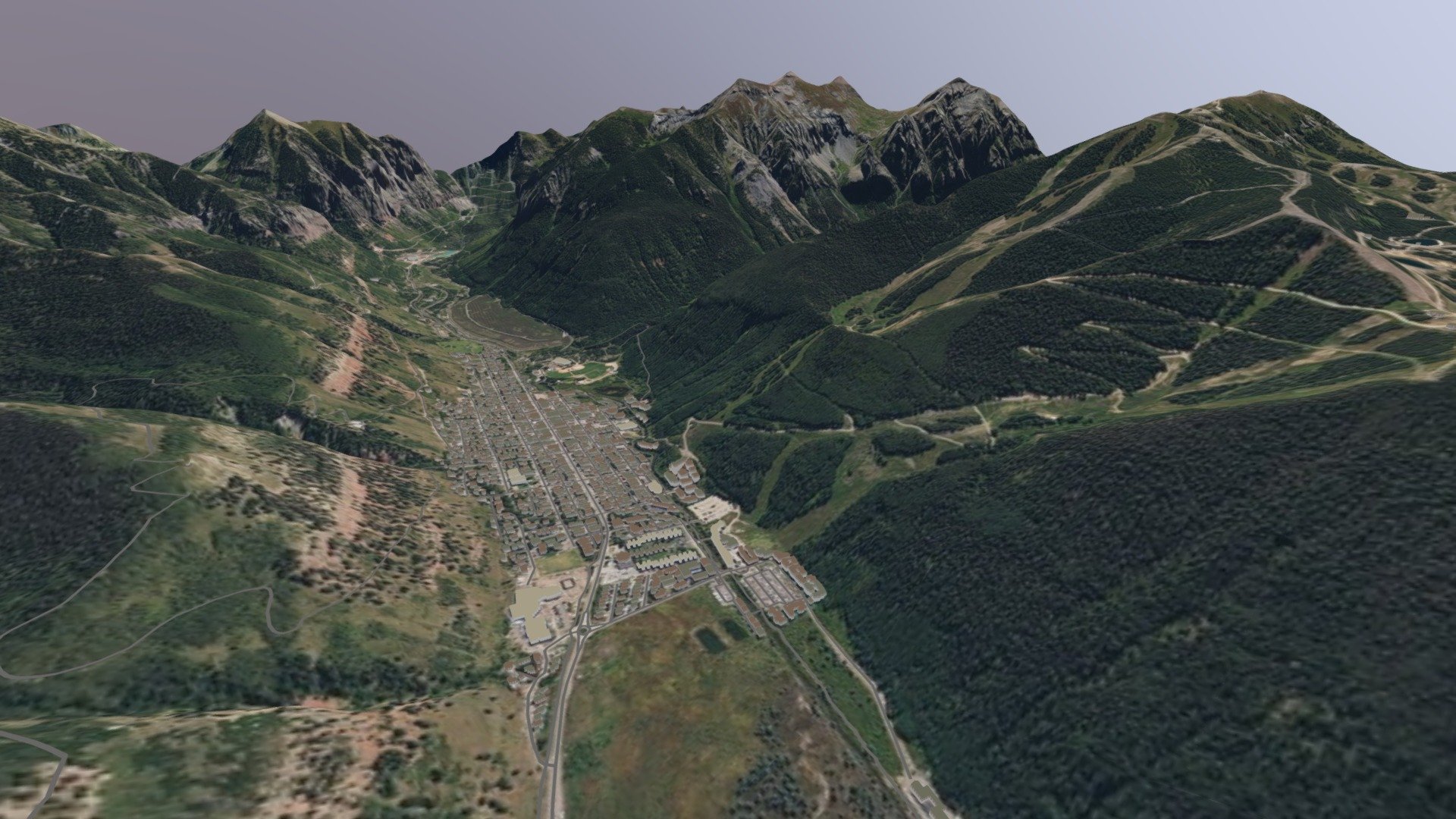
Telluride, Colorado produced with TerraTools
sketchfab
Virtual terrain of Telluride, Colorado produced using TerraTools. Data sources include USGS NED 10m elevation, USDA NAIP imagery, and OSM roads and building footprints extruded in 3D. Originally produced as FBX and converted to GLB using Blender.
Download Model from sketchfab
With this file you will be able to print Telluride, Colorado produced with TerraTools with your 3D printer. Click on the button and save the file on your computer to work, edit or customize your design. You can also find more 3D designs for printers on Telluride, Colorado produced with TerraTools.