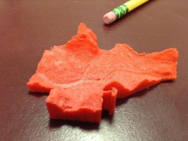
Terrain Model of Binghamton, NY
thingiverse
Digital elevation data retrieved from NY Orthos Online, tiled and converted to heightmap images with QGIS, and inefficiently converted to STL using my program hmstl. Terrain is clipped to the Binghamton city limits using a mask image derived from municipal boundaries provided by Broome County GIS. The red version pictured above was printed in ABS on a library Makerbot 2X. I have since reprinted the model in unpigmented PLA on my Printrbot Simple. Here is a short video clip of adding some detail to the PLA version with acrylic paint: http://www.youtube.com/watch?v=lhWAyQxnE68 Instructions You may need to rescale the model to fit your printer platform.
With this file you will be able to print Terrain Model of Binghamton, NY with your 3D printer. Click on the button and save the file on your computer to work, edit or customize your design. You can also find more 3D designs for printers on Terrain Model of Binghamton, NY.