Texas
thingiverse
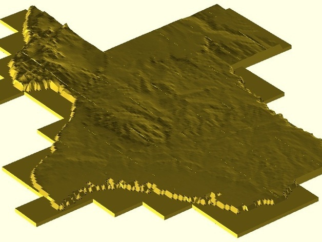
By employing the software mentioned in thing#15276, I obtained elevation data from Google Earth for Texas. Utilizing a VB program, I reversed and scaled these points, then imported them as surface files into OpenSCAD. The resulting 87-tile image is soon to be upgraded with higher resolution tiles, creating a 5'8" x 5' textured representation of the state. Each tile has excess edges, .4 mm thick, which can easily be cut off due to using OpenSCAD's surface() function. Additionally, my VB program allowed me to remove non-Texas areas from each tile; I will share both the executable and source code upon request.
With this file you will be able to print Texas with your 3D printer. Click on the button and save the file on your computer to work, edit or customize your design. You can also find more 3D designs for printers on Texas.