Texas elevation map
thingiverse
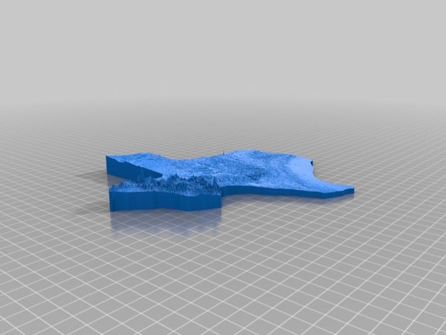
Texas elevation map (6 million: 1 in xy direction, 120,000:1 in z direction) The Texas elevation data is downloaded from Texas Natural Resources Information System, and post-processed by Matlab. Shrink Factor: 6,220,000 times. This means that 1 inch in the model corresponds to 100 miles in the xy direction. Texas was reduced from 1244 kilometers by 1150 kilometers to 200 millimeters by 185 millimeters. Elevation is vertically exaggerated by 50 times. This means that 1 mm thickness in the model corresponds to 120 meters. High Resolution: The 2D map is discretized into a 500x500 grid, which translates to a resolution of 2 kilometers in the model. Have fun printing!
With this file you will be able to print Texas elevation map with your 3D printer. Click on the button and save the file on your computer to work, edit or customize your design. You can also find more 3D designs for printers on Texas elevation map.