Topographic map of New Jersey
thingiverse
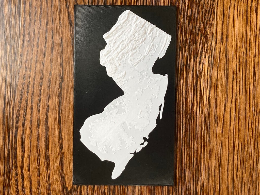
Topographic map of NJ - just New Jersey, not the surrounding states - on a backer. Inspired by a piece my sister in law had that was just an outline of NJ in a frame. I've printed topo maps in the past and thought doing this with a profile would be a cool print. Turns out I was right, but it was _not easy!_ Most of the photos are in the north because honestly the topo of south Jersey isn't what one might call terribly interesting. Warning! Not for use in navigation. This isn't even close to accurate in any meaningful way, but it's close enough for display purposes. Here's how I created it: * Load up https://jthatch.com/Terrain2STL/ and set the rectangle to encompass NJ with a little wiggle room. Bump up the elevation multiplier to the maximum. Export and save that STL. * Google image search for "new jersey outline" and pick a good black and white version. * Find a site that does image to STL conversion. Spent a bit of time trying to find one that created good output (some sites create things that look like bodies but had a multitude of errors in the resulting STL) Finally discovered https://anyconv.com/jpg-to-stl-converter/ which gave me a nice, usable STL from the NJ profile. * Load both into MeshMixer * Select the rectangular topo so it's highlighted, then look for stuff that I can use to match the scale between the extruded outline and the topo map. In this case, the Delaware river on the west border gave a nice reference and I was able to use that to adjust the scale until it lined up with the matching edge of the extruded shape. * Spend a whole bunch of time trying to get MeshMixer to perform a boolean intersection. This seems simple in concept but man oh man I wasted a bunch of time trying to get something that would actually work. Finally wound up getting it to work by reducing the poly count in both models drastically and adjusting the alignment until the intersection resulted in a usable part. * Add a box in MeshMixer, adjust the dimensions to create a backing for the map. Align the two back to back and adjust position so it looks good. * Join the two using MeshMixer combine, which is far simpler than boolean union. Also makes it easier to select the backing and remove for any future work. * Export as binary STL Most of the time spent was getting a usable STL from the profile image and doing the boolean intersection. MeshMixer always seems to be a bit tricky with boolean operations and getting the result you want requires really fiddling with all the settings. I wonder if Blendr might have had better results but I haven't learned it yet.
With this file you will be able to print Topographic map of New Jersey with your 3D printer. Click on the button and save the file on your computer to work, edit or customize your design. You can also find more 3D designs for printers on Topographic map of New Jersey.