Topographical overlay
thingiverse
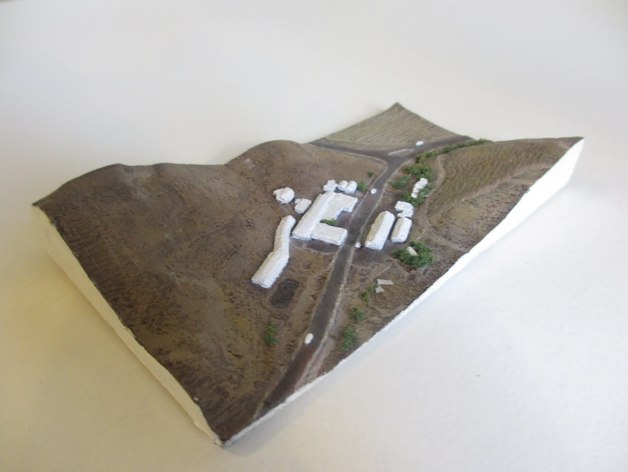
A LIDAR-derived topographical map showcases the California Napa hills' terrain. Microdem processed this data into a heightmap, while house models were created via LIDAR scans and satellite images. Finally, the model was colorized to resemble satellite photographs.
Download Model from thingiverse
With this file you will be able to print Topographical overlay with your 3D printer. Click on the button and save the file on your computer to work, edit or customize your design. You can also find more 3D designs for printers on Topographical overlay.