Ukraine topographic map (relief)
thingiverse
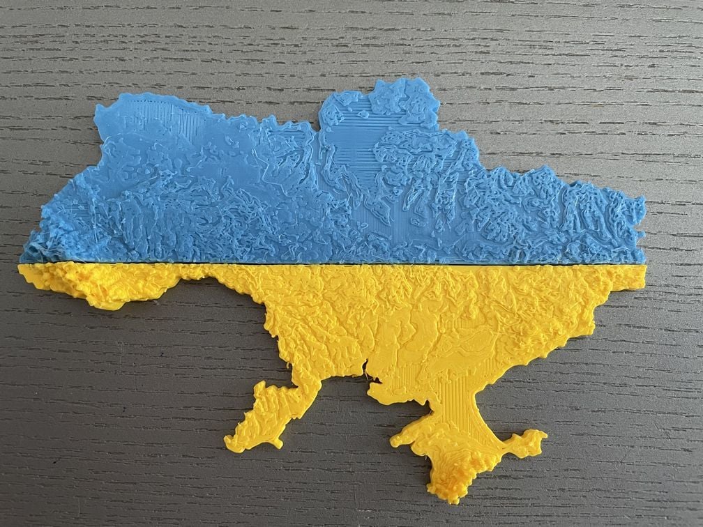
Due to recent events, I made this topographic map of the Ukraine. Scale of the model is 1:5'000'000 with a vertical exaggeration of 10. My print was done at 50% xy scale and 250% z scale leading to a overall vertical exaggeration of 50 (Ukraine is really big and flat for most parts, so in order to make the relief pop, one needs to exaggerate altitudes a lot). The model was split in two using Windows 3D Builder app and printed in blue and yellow. Elevation data was taken from SRTM 4.1 (https://www.un-spider.org/links-and-resources/data-sources/digital-elevation-model-srtm-41-cgiar-csi) Ukraine borders were taken from: https://geodata.lib.utexas.edu/catalog/stanford-nv937bq8361
With this file you will be able to print Ukraine topographic map (relief) with your 3D printer. Click on the button and save the file on your computer to work, edit or customize your design. You can also find more 3D designs for printers on Ukraine topographic map (relief).