Ukraine topography
thingiverse
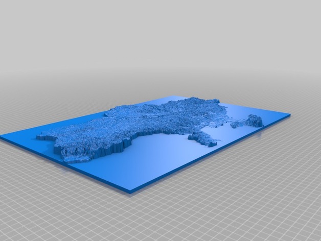
This is a topographic map of the Ukraine. It was created using Europe elevation graphical data with 1x1 km squares, taken from European Environmental Agency data.http://www.eea.europa.eu/data-and-maps/data/digital-elevation-model-of-europe Then used Heightmap2stl script by mfussi:http://www.thingiverse.com/thing:15276 Many thanks for great simple tool! Final mesh required some fixing. The used output is from the final image of 512x342 pixels. Printed with Velleman K8200, gcode was prepared with Repetier-Host using Cura Engine slicer. Print Settings Rafts: No Supports: No Resolution: 0.1 Infill: 20% Post-Printing
With this file you will be able to print Ukraine topography with your 3D printer. Click on the button and save the file on your computer to work, edit or customize your design. You can also find more 3D designs for printers on Ukraine topography.