Utah topographic map with rivers and lakes
thingiverse
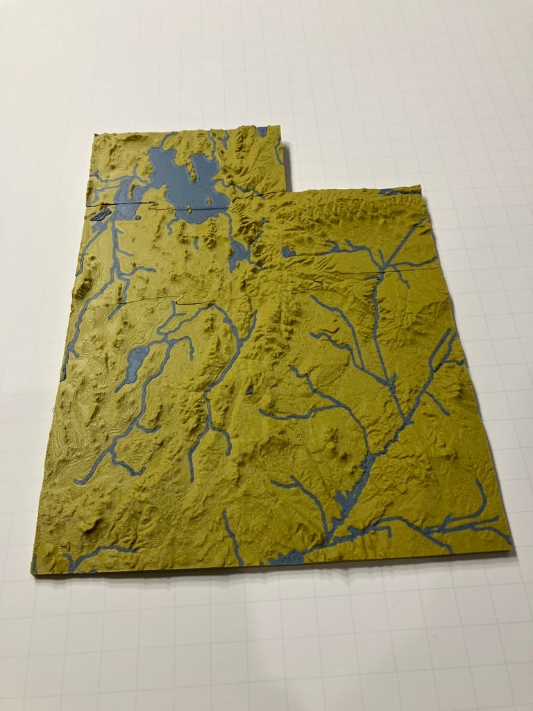
### Utah topographic map with major streams and lakes highlighted. ## This is an older version of the Utah topo map, get the newest version of Utah and Lower 48 states at https://www.printables.com/model/531881-utah-usa-ut-topographic-map-with-rivers The individual 3D printable 3MF files are cut for your convenience and fit together once printed. The files are in 3MF format instead of STL in order to store separate base and river objects that are aligned and ready to print. 3MF is supported in Cura and PrusaSlicer. Print with dual extrusion or single extrusion with Z-hop method on the rivers object. - 0.1mm layer height - 30% Lightning support. - Consider an ooze shield This was generated using [USGS GMTED2010](https://www.usgs.gov/coastal-changes-and-impacts/gmted2010), [QGIS](https://www.qgis.org/), [GDAL](https://gdal.org/), and [TouchTerrain](https://touchterrain.geol.iastate.edu/). Support open source data and software! **Specifications:** USA Contiguous Lambert Conformal Conic Derived from USGS 7.5 arc second GMTED2010 Scale 1:2500000 (1mm is 2.5km) 5x Vertical Exaggeration. Base vertical thickness is 0.5mm. Areas under 4m in height are proportionally scaled between 0.5-1.5mm. *Streams with upstream drainage areas greater than 1000km² and lakes with areas greater than 10km² are highlighted and displayed at approximately 0.5-1km resolution for visibility. *
With this file you will be able to print Utah topographic map with rivers and lakes with your 3D printer. Click on the button and save the file on your computer to work, edit or customize your design. You can also find more 3D designs for printers on Utah topographic map with rivers and lakes.