Victorian Boundary Marker (Leigh, Lancashire)
sketchfab
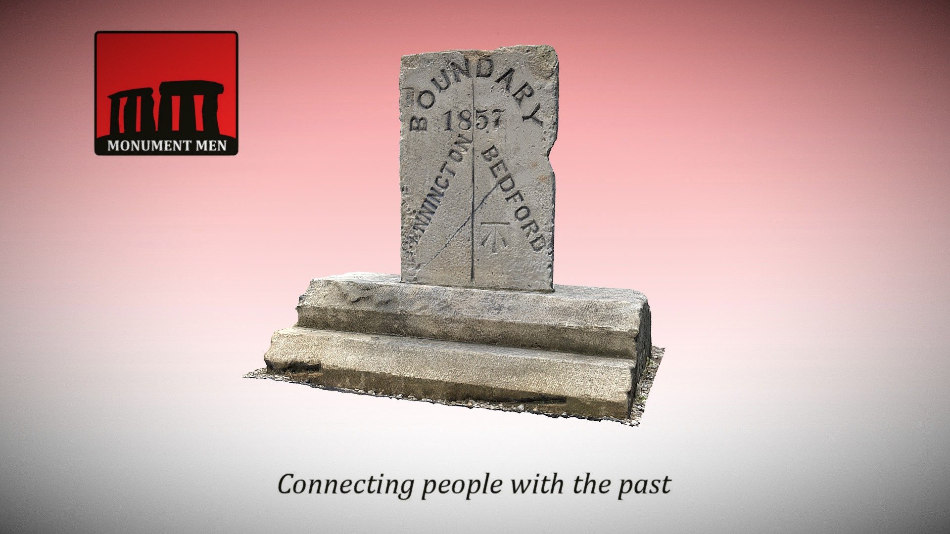
Boundary marker circa 1857, depicting the boundary between the townships of Bedford and Pennington in the parish of Leigh, Lancashire. Google Maps location: https://goo.gl/maps/7LtUroNsRz42 3D scan generated by Lee Robert McStein.
Download Model from sketchfab
With this file you will be able to print Victorian Boundary Marker (Leigh, Lancashire) with your 3D printer. Click on the button and save the file on your computer to work, edit or customize your design. You can also find more 3D designs for printers on Victorian Boundary Marker (Leigh, Lancashire).