Virgil Crest Ultramarathon trail segments
thingiverse
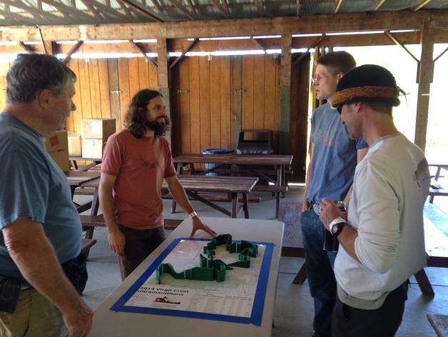
Segments of elevation course map printed for display at the 2014 Virgil Crest Ultramarathons. http://www.virgilcrestultras.com/ Elevation maps add another dimension (quite literally) to typical course maps, improving athletes' ability to visualize and anticipate the terrain ahead. Created with http://gpxtruder.xyz/ (and some manual post-processing to cut the course model into segments printable on my Printrbot Simple). Use GPXtruder to create printable models of GPX tracks of your own adventures.
With this file you will be able to print Virgil Crest Ultramarathon trail segments with your 3D printer. Click on the button and save the file on your computer to work, edit or customize your design. You can also find more 3D designs for printers on Virgil Crest Ultramarathon trail segments.