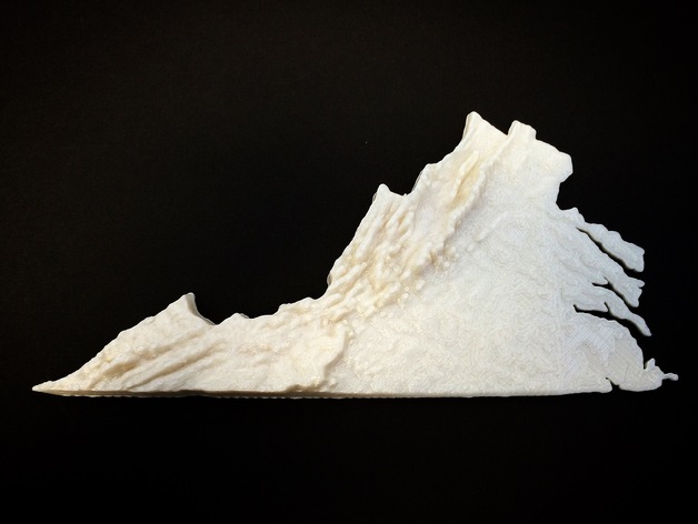
Virginia Topographic Map
thingiverse
A topographic map of Virginia was created through a fantastic tutorial provided by @anoved. The task of creating height maps of large regions is simplified using this method. A link to the tutorial can be found at http://anoved.net/2015/09/creating-heightmaps-of-large-regions/. Several years ago, an elementary teacher requested this model for use as a classroom manipulative but no suitable method was available at that time. After tweeting a call for assistance, @anoved stepped up with the tutorial and helped fulfill the teacher's request. The base of the model has been thickened to make it printable and the z-height has been exaggerated to serve as an effective learning tool. A remix with accurate z-height scaling would be highly beneficial to the community. In addition, a copy of the map was provided to a local teacher of visually impaired students. For those interested in printing smaller rectangular regions, http://jthatch.com/terrain2stl/ is a user-friendly website that can assist with this task. If you have any suggestions for an easier method to create topographic/height maps of large regions, please leave a comment or contact me on Twitter at @DesignMakeTeach. The remix in Tinkercad is available at https://www.tinkercad.com/things/j6njRIhJRhk. Printer Settings: Brand: Ultimaker Model: Ultimaker 2 Rafts: No Raft Used Supports: None Needed Resolution: 0.3mm Infill Percentage: 100% Notes: Printed quickly with a 0.8mm nozzle.
With this file you will be able to print Virginia Topographic Map with your 3D printer. Click on the button and save the file on your computer to work, edit or customize your design. You can also find more 3D designs for printers on Virginia Topographic Map.