Washington state topographic map
thingiverse
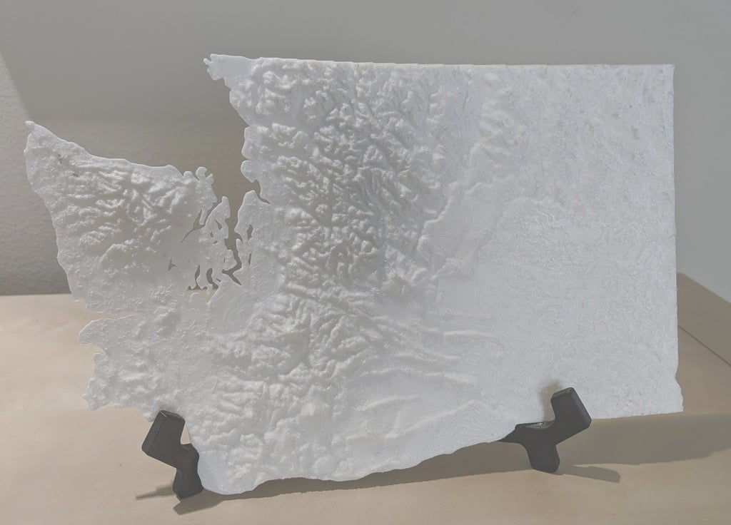
Topographic map of Washington state based on a TouchTerrain model. I've removed islands (for printability, sorry!) and the borders are basically hand-drawn. And I had to exaggerate the z-axis to make everything visible. Otherwise, it's pretty accurate! Print on the lowest resolution you can manage unless you want thick layer lines. Stringing is a problem in the valleys, so think consider lower print temperatures or blast the finished print with a heat gun.
Download Model from thingiverse
With this file you will be able to print Washington state topographic map with your 3D printer. Click on the button and save the file on your computer to work, edit or customize your design. You can also find more 3D designs for printers on Washington state topographic map.