West Horton 1a (March 2007)
sketchfab
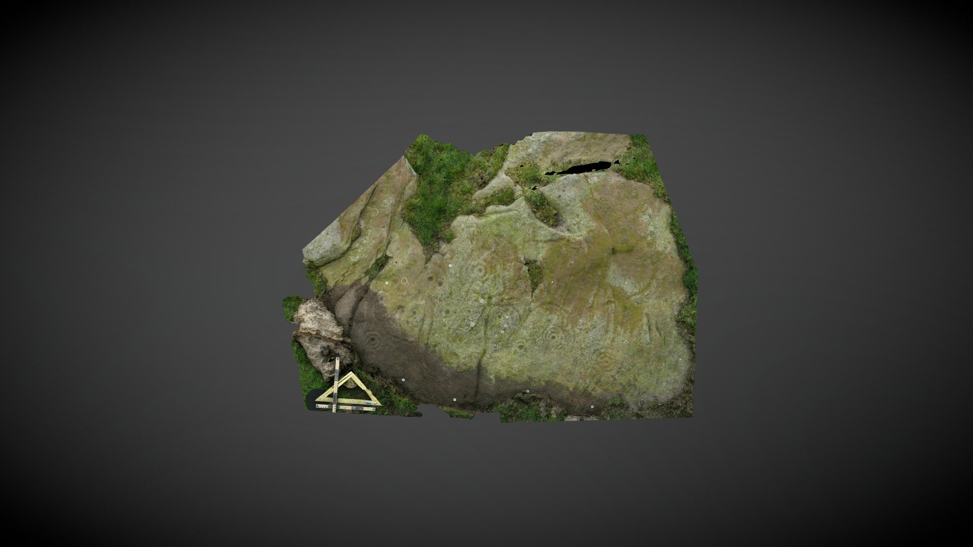
Prominent outcropping on private farmland, just over half a mile NW of West Horton, Northumberland. Largest of the 5 carved exposures running along this 60m stretch of outcropping, it measures approximately 3m x 2m and appears on the north facing slope. Motifs consist of a variation of cup and ring motifs and unusual long curvilinear grooves partially enclosing other motifs. Whilst some designs are extremely eroded, others near the base still display tooling marks, suggesting they’ve been covered for centuries / millennia. Recorded on the Beckensall Archive (BA) as ‘West Horton 1a’ it was added to ERA by NADRAP in 2008. Unfortunately, both the NADRAP and BA records are minimal (presumably removed in error):https://archaeologydataservice.ac.uk/era/section/panel/overview.jsf?eraId=65 Historic England scheduling: https://historicengland.org.uk/listing/the-list/list-entry/1006532 Model created from 11 stereo pairs captured by Kevin Malloy in March 2007. Imagery forms part of the NADRAP / ERA archive.
With this file you will be able to print West Horton 1a (March 2007) with your 3D printer. Click on the button and save the file on your computer to work, edit or customize your design. You can also find more 3D designs for printers on West Horton 1a (March 2007).