White Mountains - New Hampshire
thingiverse
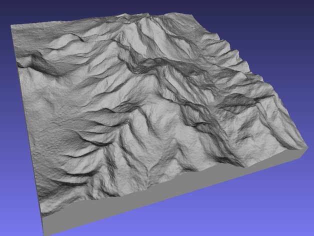
Constructed using 1 arcsecond resolution SRTM data from the Space Shuttle (about 1.4 million facets). Mount Washington, the highest point in the New England, is near the center and you can see the Great Gulf and Tuckerman's Ravine. It was made using a new and, as yet, unreleased version of SRTM2STL. The source code for creating files at 3 arcsecond resolution is available up on github under the GNU license. Go to github and search for SRTM2STL. Instructions I have good luck printing large maps using ABS on a heated bed. PLA also works on a heated bed but, ABS won't warp like PLA if you leave your maps in a hot car (as I have).
With this file you will be able to print White Mountains - New Hampshire with your 3D printer. Click on the button and save the file on your computer to work, edit or customize your design. You can also find more 3D designs for printers on White Mountains - New Hampshire.