world map based on good countries index (2017)
myminifactory
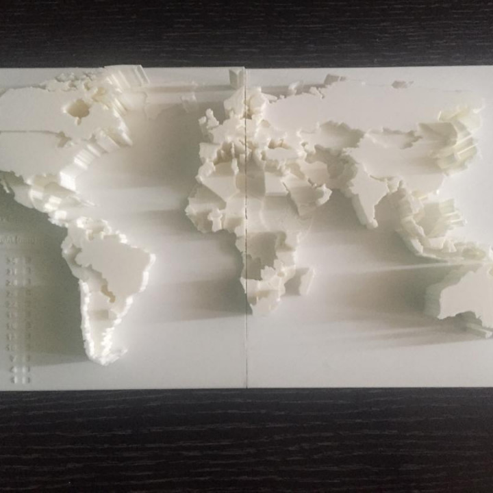
This 3D printed world map showcases rankings by country according to the Good Country Index 1.2 (2007). For more details, visit Wikipedia at https://en.wikipedia.org/wiki/Good_Country_Index. I adjusted each color's height to reflect performance, so higher altitude indicates a better ranking. While it is possible to add color to this printed object, I consider it a work of art and don't have the capability to do so. This method can be used to display any index, such as GDP or population statistics, for countries worldwide.
With this file you will be able to print world map based on good countries index (2017) with your 3D printer. Click on the button and save the file on your computer to work, edit or customize your design. You can also find more 3D designs for printers on world map based on good countries index (2017).