Yosemite Half Dome Trail Map
thingiverse
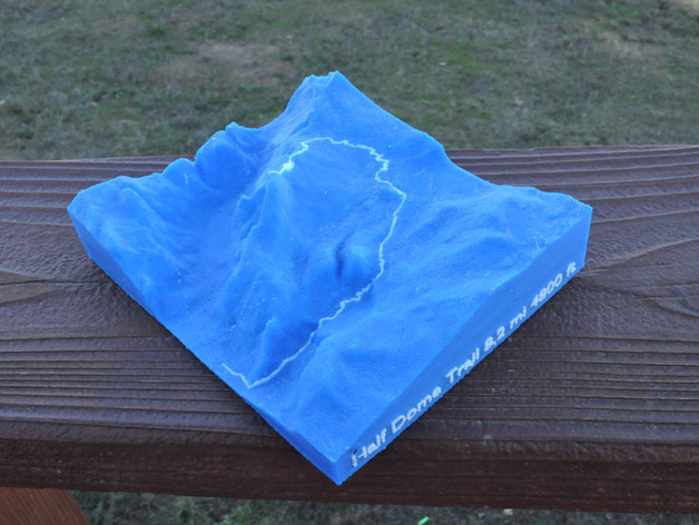
A dual extruder version of the Half Dome 3d topo which prints the path of the trail on the second extruder. Also note the lettering on the side (why not since you've got the other extruder hotted up anyway) Note the detail photo showing the infamous cableway section. Complete instructions on how to make models from digital elevation data can be found on my blog at http://www.the3dprintedfuture.com/shapespeare/?p=1 Instructions DEM data comes from The National Map 1/3 arc sec data set. Trail location comes from 7.5' topo. Modeled in Blender Sample printed on FlashForgeCreator with ABS. 7hrs 39min build time.
With this file you will be able to print Yosemite Half Dome Trail Map with your 3D printer. Click on the button and save the file on your computer to work, edit or customize your design. You can also find more 3D designs for printers on Yosemite Half Dome Trail Map.